… in reality, mistakes are called learning, and the state of no mistake is called nowness. In nowness there is no before or after, no goals, agendas, or fixed direction. Like the meandering river, it twists and turns in accord with circumstances but always knows how to find its way to the great ocean. If you wish to travel like this, you must go alone, not carry any baggage, and trust yourself implicitly…* —Daido Roshi
These are the words I ponder as I embark on another epic running adventure. It’s around 3 am on a cold morning at the south rim of the Grand Canyon. After spending a restless, shivery night in my tent, I’m about as ready as I’ll ever be. Have I forgotten anything? It’s going to be a long day (and night) and I don’t want to make any mistakes in my steps crossing the grand canyon, TWICE! I take off from the Mather Campground all alone under a dark, star filled sky.
In a couple miles I pick up the S. Kaibab trail where I start the plunge down into the heart of Mother Earth. Strong gusts of wind whip up out the canyon and hit me in the face. I switchback down the canyon wall along many terraces made with cedar planks and flat slabs of rock. My feet kick up a fine talcum-like dust that floats down into the beam of my headlamp as I turn each switchback, obscuring my view. My gaze locks onto the oval of light, where I concentrate solely on the trail. Although I can’t see it, I know there’s a precipitous drop just a few feet away, but I dare not look at it. I don’t want to make any mistakes and end up at the bottom of the canyon, so I remain focused and trust myself. Running down is tricky because some of the steps have deep depressions where mule trains have worn away the tread, causing my feet to suddenly slip into the pit. I avoid the middle part of the terraces where the holes are and opt for the edge or the planks instead. This seems to work, but the constant jarring of the stairs does a number on my back and joints. From the south rim to the canyon floor is a one mile vertical drop, about 5000’, while the climb up to the north rim is almost 6000’. Soon I’m hot so I stop to shed my jacket. I increase my fluids because the high temperature in the canyon is supposed to reach the mid 90s today. |
| The Black Bridge |
I reach Skeleton Point, a large flat area with a supposed view of the river, but I can’t see anything in the dark. Paths go in all directions made by people looking for the perfect selfie stick angle. I lose the main trail here and spend a few minutes searching for the route down, making sure not to walk off the edge; eventually I find my way.
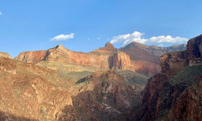
In a few hours the sky begins to lighten and I can finally see the canyon, but only a dark silhouette of the prominent buttes, temples and shrines. Zoroaster Temple is the most recognizable because of its pyramid shaped peak. Other formations are named for deities and gods including Buddha, Vishnu, Shiva, Deva, Brahma, Isis, Thor and Apollo.
 |
| Zoroaster Temple seen in daylight |
U.S. Army officer, cartographer, geologist and philosopher Clarence Dutton instigated this naming convention on a mapping survey in the 1870s. A worldly man, he noted that the most impressive formations were reminiscent of the ancient religious pagodas found throughout Asia. Greek and Roman mythological figures were also referenced for their epic symbology.
In addition, Native Americans, who’ve inhabited this area for centuries, consider the canyon to be sacred. The NPS writes,
Many American Indian tribes have close and sacred cultural ties to Grand Canyon, including the Hualapai, the Havasupai, the Hopi, the Kaibab Band of Paiute, the Navajo Nation, the Pueblo of Zuni, the San Juan Southern Paiute, Paiute Indian Tribe of Utah, and the White Mountain Apache. Some of these tribes consider Grand Canyon to be their place of origin/emergence and homeland.
So, as you can see, the Grand Canyon is the perfect place to experience a spiritual transformation; you can feel the energy of celestial beings as well as the ancestors who came before us.
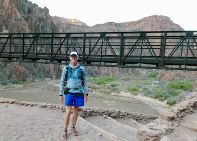 |
| The Black Bridge |
I continue on my way through the muleteer camp reaching a narrow gorge where I meander along the stream with towering walls above me. I crisscross the creek on the many bridges that have been built and run beside beautiful stone walls that keep the dirt path from washing into the creek. it’s pretty flat here, but I don’t get too excited because I know the climb up to the N. Rim is looming. Don’t think about it, just stay in the now, I tell myself.
In about five miles, I reach a direction sign for Ribbon Falls which is on the other side of the main stream —left via stream or right via footbridge. Well, the bridge has since been destroyed by flooding and been removed, so there is really only one way to cross the main stream to visit the falls. This reminds me of the quote at the beginning of this post and a zen koan I’ve been working on. I ask myself, What is the state without mistakes?Here’s the situation:
Zen master Sengmi of Shenshan crossed a river with his dharma brother Dongshan.
Dongshan: “Don’t make a mistake with your steps and slip into the current.”
Shenshan: “If I make a mistake with my steps, then I won’t live to cross the river.”
Dongshan: “What is the state without mistakes?”
Shenshan: “Crossing the river with the elder.”
Face-to-face, there is nothing hidden, yet fundamentally, there is no way of explaining it all. No self and no other, then how can we speak of right and wrong? Dongshan and Shenshan are from the same household. Both know well the contents of the kitchen pantry…*
—Daido Roshi
Staying in nowness, I turn right towards the nonexistent footbridge. The trail is steep taking me up and away from the creek where, pretty soon, I run back down to pick up the trail beside the stream again. I reach Cottonwood Campground where there is a ranger station under a grove of cottonwood trees. Eventually the trail brings me to a water crossing above a waterfall. Don’t make a mistake with your steps and slip into the current! I tell myself. Trust yourself implicitly. Stay in nowness. …no before or after, no goals, agendas, or fixed direction. Fortunately, I make it across without incident. While the water crossing is low this year, in years past it’s been quite high where I almost decided to turn back.
 |
| Crossing the river with the elder in 2017 |
 |
| Cottonwood Campground Ranger Station |
 |
| Roaring Springs |
In a while, I realize that I have lost one of my 8oz water bottles that must have fallen out of my waist belt. I still have one more, in addition to my two 15 oz soft flasks in my hydration pack, but It will be a long time before I make it back to Manzanita to refill. The N. Rim is closed and the water is shut off this time of year. I think about going back down, but decide to wait until I return to look for it. My careless mistake, and it’s going to be hot as blazes this afternoon!
I slowly slog upwards with towering red cliffs above and below me with scrubby vegetation dotting the hills and juniper and pinyon pines hanging precariously on the cliff sides by exposed roots. There are many layers of different hues of rock eroded into pinnacles, turrets, hoodoos, and moss covered circular walls. The variety of rock formations is overwhelming at times; the beauty unsurpassable. The climb is tough though, so I occasionally take short breaks to let my lungs and heart catch up. I eat some apples and mandarines to boost my energy. |
| Supai Tunnel |
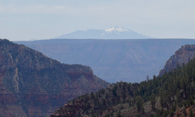 |
| Humphreys Peak |
Water comes from high mountain sources.
Water runs deep in the Earth.
Miraculously, water reaches us and sustains all life.
My gratitude is filled to the brim.
—Thich Nhat Hanh
I eat some lunch and rehydrate before I tackle the hottest part of the day in the bottom of the canyon. I try not to dawdle because I still have a long journey ahead of me and it’s already after 1:00pm. I cross over the Bright Angel Creek via a footbridge and run beside the singing brook as I contemplate, What is the state without mistakes? Nowness! |
| lechuguilla |
A lichen is a simple biological “community” because it is made up of at least two mutually-dependent organisms…some type of fungi is found along with green algae and /or cyanobacteria.
A lichen community is therefore stronger than either fungus or algae alone… the green algae uses the photosynthesis process to produce food for the fungus, while the fungus protects the algae from the elements and extracts nutrients from the rocks and soil.
 |
| Living Rock |
..the meandering river, twists and turns in accord with circumstances but always knows how to find its way to the great ocean.*
 |
| Silver Bridge |
 |
| Zoroaster Temple in the distance |
 |
| Devil's Corkscrew |
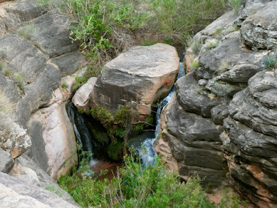
Eventually the trail becomes very marshy and the vegetation lush; my indication that I’m nearing the Indian Gardens Campground where there is a water fill station. I pass another group of hikers; one of them asks, “How much farther is it to Indian Gardens Campground?” I tell him that we are almost there. I reach an interesting waterfall below the trail where a flat topped round rock slices the creek in two, creating a double waterfall. I get to the campground where I fill my bottles for the last time. Only five more miles to go, but unfortunately they are damn near straight up.
The sun grows dimmer as I slog upwards and soon I have to don my headlamp. As the evening grows dark, stars fill the sky. Beautiful! My legs feel like concrete so I use my poles to help push myself along. My body overheats even though the air has cooled considerably. This is truly a soul crushing climb after already having completed over 45 miles. My mood sinks and I begin to doubt myself. How much further is it? I look up and can see headlamps moving high above me, which is disheartening. Maybe there isn’t a top. I reach the 1.5 Mile Rest House and begin climbing the last series of switchbacks. My lungs burn and I can hear my heart thumping inside my chest. I frequently must stop to lean on my poles and let my heart catch up. I pass some defeated looking hikers sitting on the side of the trail. “So close, yet so far!” one of them says. The seemingly never ending climb goes on and on where one mile seems like 10, but each step is one step closer to transformation; one step closer to peace. Each step IS transformation; peace is every step. |
| The final tunnel |
I pass through a rock tunnel and continue the arduous task upwards, sweating all the time. Several ladies are sitting on a rock and one of them says to me, “Good job, will you do me a favor?.” “What’s that?”, I ask. “When you get to the top, will you shout out a WHOOOOO-HOOOOO!” I laugh and then answer, “I’ll try, but my throat is parched from sucking dry air all day and I’ve lost my voice.” I have zero energy and am completely drowsy after covering 50 miles in almost 18 hours. All I can think about right now is crawling into my sleeping bag.
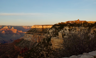 |
| S. Rim |
Capping Verse:
A hazy autumn moon, solitary and full,
falls as it may on the winding river ahead.
There are those who seek perfect clarity,
yet, sweep as they may, they cannot empty the mind.*
See you on the trail
* From The True Dharma Eye, Master Dogan’s Three Hundred Koans (Case 198) with commentary and verse by John Daido Loori


