Last month I ran the Baylor Pass and Pine Tree Loop trails in the Organ Mountains-Desert Peaks National Monument in Las Cruces, NM. This is a challenging route that takes you over Baylor Pass (6400’) and down to Aguirre Springs Campground for a total roundtrip of 12 miles. From the campground, you can run the Pine Tree Loop which adds an extra 4 miles and takes you up to almost 6900’. The trail takes you high onto the eastern slopes of the mountains where you have spectacular views of the angular peaks of the Organ Needles with Ponderosa pines towering above you.
 |
| Organ Mountains |
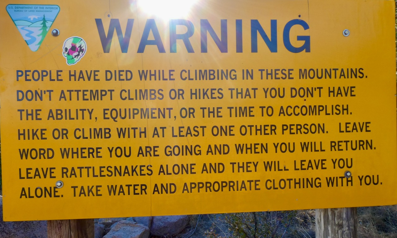
I started out on the west side from the Baylor Canyon Rd parking area off of HWY 70 where cows were grazing lazily around the park sign that warned: PEOPLE HAVE DIED IN THESE MOUNTAINS, BLAH, BLAH, BLAH…DON’T HIKE ALONE, BLAH, BLAH, BLAH…LEAVE RATTLESNAKES ALONE…TAKE APPROPRIATE CLOTHING, YADDA, YADDA, ETC., ETC.
Anyway, I ran past the sign all alone and without any extra clothing, not knowing whether or not I would ever see it again. The flat trail in this area is quite eroded, but improves as you begin climbing into the canyon. Large round smooth boulders are scattered around willy-nilly; the trail weaving in between them. Cacti and other prickly plants line the trail and there are some high steps and water bars for erosion control that have to be negotiated carefully. In about a mile I reached a large mound of goblin-like smooth boulders where there were excellent views of Las Cruces and the Rio Grande Valley below.


I climbed the gradual uphill trail with huge walls of yellow, lichen tinged rock high above me. In about an hour and half I reached the saddle at mile 3.5 where I enjoyed fine views of White Sands Missile Range and the vast desert below under a bright azure sky with wispy clouds.

Did you know the sky appears a deeper blue the higher in elevation you go? The reason is that there are fewer water droplets, dust and other particles in the atmosphere to scatter light waves. A Swiss scientist named Horace-Bénédict de Saussure noticed this phenomenon while climbing in the Alps in 1786 and he even invented a devise for measuring the color blue. His cyanometer was a circular donut like ring with 52 shades of blue that you could hold up to the sky.
Atlas Obscura writes,
The color [Saussure] had measured at the top of Mont Blanc, he later determined, corresponded to a blue of the 39th degree; that measurement was later surpassed by the famous geographer Alexander von Humboldt, who took his cyanometer on journeys across the Atlantic… and also took the tool on an ascent of the Andean mountain Chimborazo, where he set a new record, at the 46th degree of blue, for the darkest sky ever measured.

Anyway, I soaked in the blueness of a big beautiful sky and then pulled out my trekking poles because this is where the serious climbing really starts. I headed north following a trail that took me along the western slope of the main ridge line. I could see a peak above the trail and assumed that was my destination. Pretty soon I started to climb up the steep slope on a crumbly sketchy path. It was hard to follow in places and I had to traverse some slabs of rock.


 |
| The obstacle in front of Baylor Peak |
In addition, I began to second guess my decision to climb in running shorts without any extra clothes or rain shell in my pack in case I suffered an injury and became stranded on the mountain. The big yellow sign that read: WARNING! PEOPLE HAVE DIED IN THESE MOUNTAINS suddenly popped into my mind. I thought about turning around at this spot, but I was so close to my goal.

Anyway, I had read about the route on the internet and, as you know, everything you hear on the internet is true. Well, “they” say there’s a safe way to get across this obstacle by “staying to the left of the broad ridge. The east side gets very steep and cliffy.” Remembering this tidbit, I backtracked, climbing off the high boulders and found a route along the left side of the ridge. It was still a bit hairy in spots where a slip on the loose dirt would send you down, down, down to who knows where.

I gingerly made my way around this barrier and continued up towards the main peak. There were plenty of boulders and prickly plants to skirt and a few high steps to negotiate. Soon I reached a steep wide crack in the side of the mountain and had to use my hands to climb up through it. I plodded on following a faint path where the slope eventually leveled off. After much toil and a few terrifying moments I finally reached a pile of rocks on the summit.
 |
| The Peak |

The 360 degree panorama was really stunning with mountain ranges rising up all over the flat desert below. In addition to the missile range base, I could see the NASA facility. Here they have been testing rocket propulsion systems since 1964 including ones for the Apollo Command and Service Module and the Lunar Module.
 |
| NASA White Sands |
According to NASA, “Since the first rocket engine test in 1964, White Sands Test Facility has tested over 700 rocket engines in more than 4 million firings for NASA, other government agencies, and private industry.”
This facility also tested systems for the shuttle orbiters and is currently testing for space craft that will take man back to the moon and beyond in the coming years. It would have been nice to have had a rocket powered jet pack to fly off the mountain on this particular day, but no such doing. I had to descend the hard way. Sadly, most mountaineering accidents happen on the way down, so I had to really keep my wits about me.

I started down and couldn’t remember the path that I took as there were many faint trails on the peak leading downward. I cautiously picked my way around the cacti and succulents and used my poles frequently to keep from sliding on loose rocks. I made it down to the scary ridge and found a trail on the east side that seemed safe enough at first and then I crossed back over to the west side.
 |
| Scary Ridge looking south |
Once over this obstacle I slowly made my way down the slope by digging my feet in sideways to keep from sliding on the dirt. I lost the way several times, but usually found a well worn path to follow. I had to butt slide in several places and also sit down and use my poles to ease myself down off of the higher steps.
At one point I lost traction and my feet slipped out from under me sending me down on my ass. At least I didn’t put my hand into a cactus like I did on my last big adventure in the Franklin Mountains. Nevertheless, I had a big strawberry on my bum from when I slid on the rocks. The descent took as long the ascent because it was so treacherous but I eventually made it back to the main trail at the pass.

I stowed away my poles and cruised down the mountain hopping down the steps of rock as I went lower and lower. I felt like I was flying because the climb to the peak was so painfully labored. Honestly, this was the first real running I had done all day. The trail took a lot of twists and turns along the side of the canyon and I reached a large mass of boulders stacked up on one another. A little sparrow was perched on top of one of them happily enjoying the wind ruffling its feathers. I stopped to take a closer look and it didn’t spook at all, it seemed happy as a lark enjoying the beautiful day. I also felt free as a bird and happy to be alive as I ran the rest of the way back to my car.

There’s nothing in the world more liberating than spending a day in the mountains on a cool sunny day. The peace and quiet is unsurpassed here in the Organ Mountains and I was glad to have made it back to the “WARNING” sign with all my limbs intact and my body in one piece. This national monument is a vast desert and mountainous playground with a rich archeological history and an abundance of natural beauty.
See you on the trail.
No comments:
Post a Comment