Saying Picacho Peak is like saying the Rio Grande River or River Big River, because picacho is to peak as rio is to river. It seems redundant to say Peak Peak so I will just say Picacho.

Picacho Peak Recreation Area, run by the Bureau of Land Management (BLM), is on the outskirts of Las Cruces, NM and is only a short drive from I-10. Recent improvements include a gravel parking area and a few covered picnic tables. Several weeks ago I ran the trails here with my dogs on a chilly morning.

Before departing I studied the trailhead map which had a warning in the lower right hand corner that read: “No warranty is made by the BLM as to the accuracy, reliability, or completeness of these data...Spatial information may not meet National Map Accuracy Standards...” Hmmmm...hopefully we won’t get too lost.


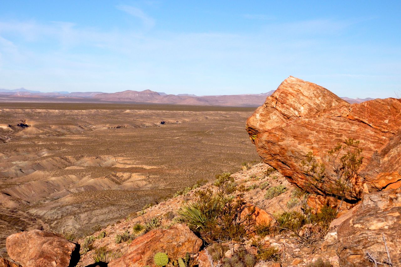
Nevertheless, the dogs and I started out in a counter clockwise direction on the Picacho Peak loop trail which took us to the top of the almost 5000 ft peak. The climb was not too steep and we enjoyed a 360 degree panorama of the Mesilla Valley, Mt Riley, the Organ Mountains and many mesas rising from the desert floor.


To descend the other side of the mountain, I decided to take the old foot trail instead of the dirt road. The single track was much more interesting and included about 30 switchbacks which led us to the canyon trail below. A herd of cows were grazing on the steep mountain slope and gave us that “HEY, what are you guys doing on our turf!” look as we ran by.

After reaching the bottom we turned into a canyon that apparently is part of the old Butterfield Overland Mail route. Some interesting cliffs and rock formations were the highlight of the trail until we reached a rusted metal stock tank with plenty of aquatic plants growing out of it. It was something like a Japanese koi pond, but with an ol’ west flare. Pretty, but kind of rough around the edges if you know what I mean.


After running for a bit longer we came across a small natural pool in the rocks where the dogs stopped for a cool drink. Water is a precious commodity in this parched desert and we later came across a plastic pipe that had been used for watering livestock. It seems a rodent of some sort had chewed right through it in search of a drink.


We followed a sandy road and then a footpath to get back around to the front of the mountain where we ended our little adventure. Picacho Peak is a nice place to explore and is not too difficult of a hike or run. You can gain some elevation without killing yourself and then enjoy a mostly flat trip through the canyon. For driving directions follow this BLM link, but be advised they are not responsible for the accuracy, reliability or completeness.

See you on the trail.